Intelligence Platform

SKY-I™ transforms fragmented, outdated space environmental data scattered across multiple sources into a single, comprehensive platform. This eliminates the time-consuming manual aggregation process that currently forces engineers to waste valuable resources gathering information from disparate sources.

SKY-I dramatically speeds up mission planning cycles from months to hours by delivering immediately actionable intelligence. This rapid turnaround eliminates delays and reduces the mission planning bottlenecks that contribute to the one-in-five spacecraft experiencing mission delays or failures.

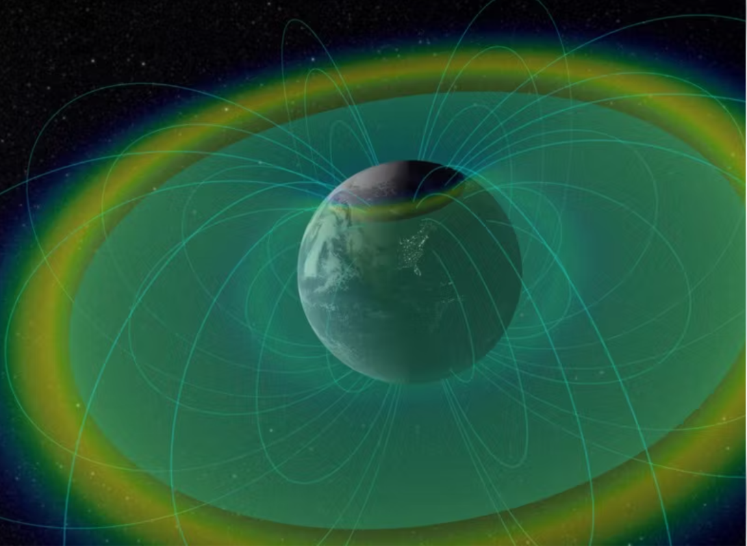
SKY-I™ delivers trusted environmental intelligence from VLEO to cislunar space, giving operators the confidence to plan and execute missions across contested regimes. By closing data gaps in poorly understood environments, we reduce uncertainty, strengthen manoeuvre planning, and ensure mission-critical assets remain protected.
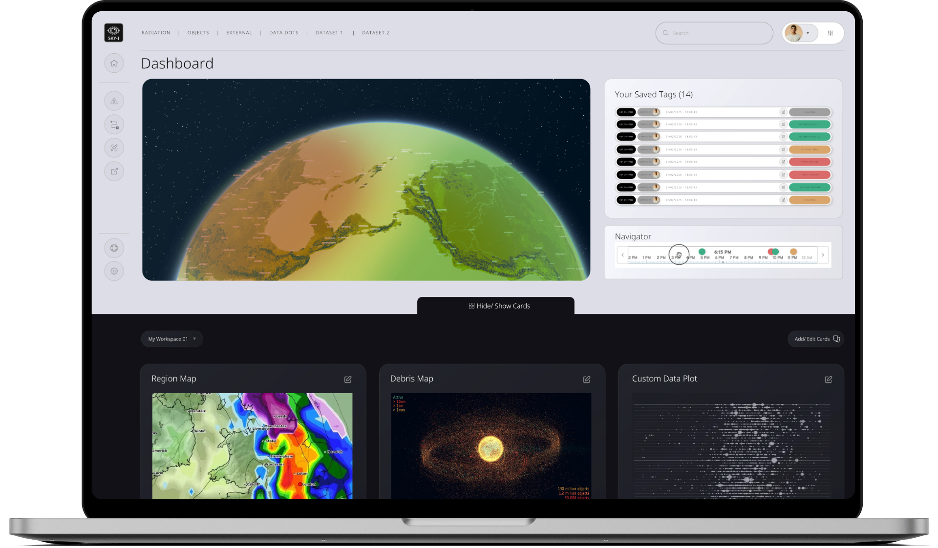
Immersive 3D mapping of space environments that displays live orbital conditions, satellite positions, and environmental hazards with unprecedented clarity and detail.

Advanced tagging capabilities that enable users to identify, categorise, and track space environmental anomalies whilst attributing their sources for comprehensive threat intelligence, allowing operators to distinguish between natural space weather events and potential adversarial activities for enhanced situational awareness.

Flexible dashboard architecture that allows users to configure personalised views of mission-critical data, metrics, and visualisations tailored to their specific operational requirements.
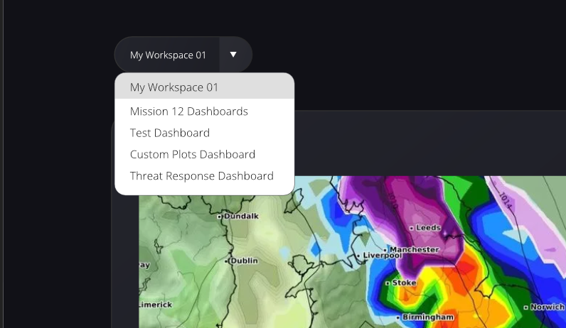
Seamlessly save and switch between different dashboard configurations optimised for various missions, teams, or operational scenarios without losing your customised layouts.
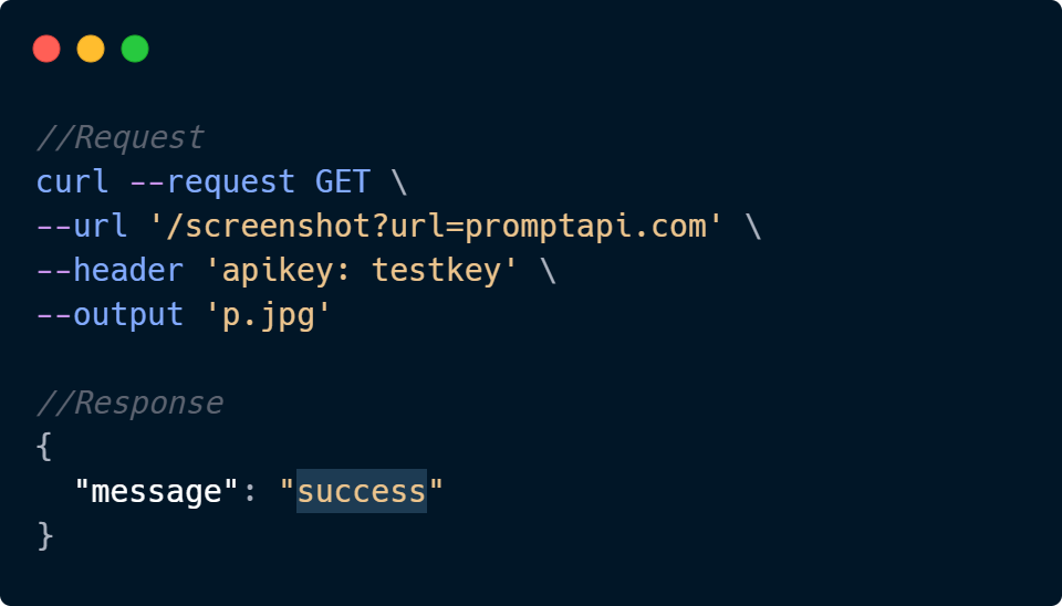
Comprehensive API integration that enables seamless data flow between SKY-I™ and your existing mission planning systems, tools, and operational workflows.